

August 28, 2017
Renova Hot Springs
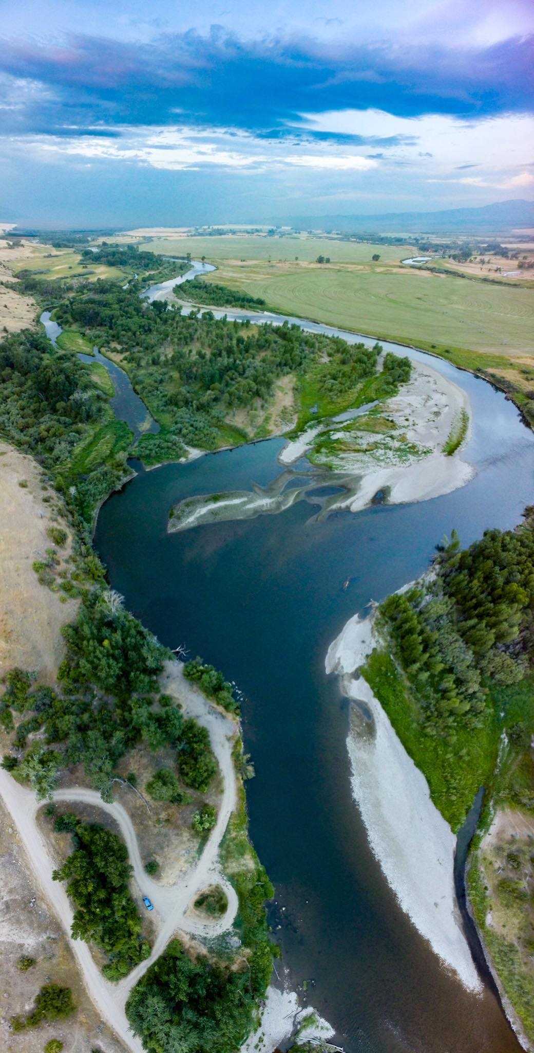
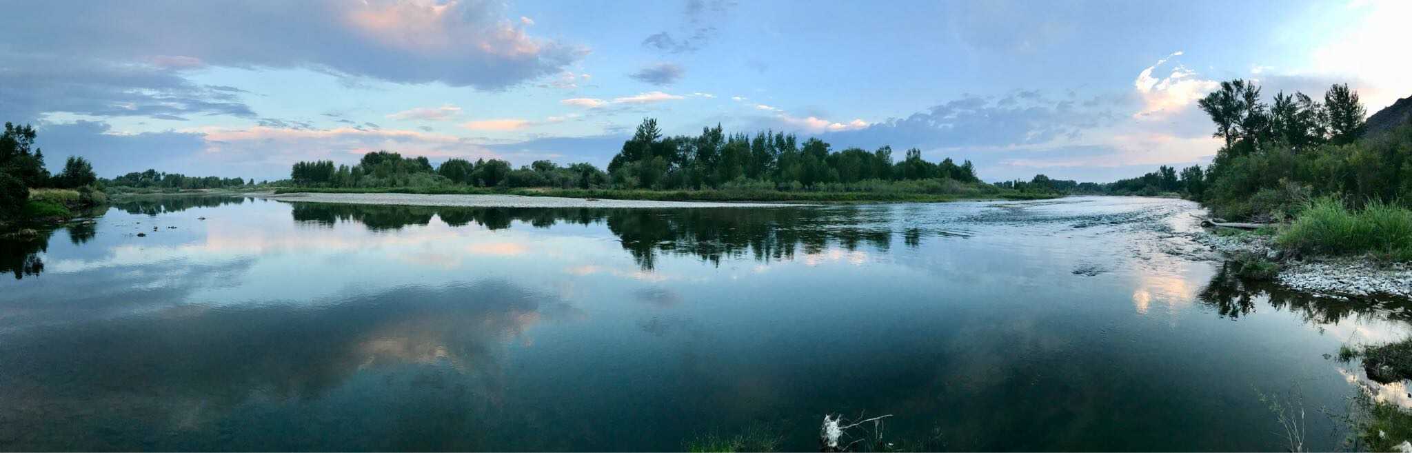
10.0 kmA short drive south of I-90 between Butte, MT and Bozeman, MT will bring you to a relatively unknown hot springs near the town of Renova. Any passenger vehicle can make the trek to the roadside spring, which features several pools of hot water mixed with the cool Jefferson River. A great way to relax when on the road!
RenovaVerticalPano.jpg
August 14, 2017
Renova Hot Springs, MT
10.0 kmA short drive south of I-90 between Butte, MT and Bozeman, MT will bring you to a relatively unknown hot springs near the town of Renova. Any passenger vehicle can make the trek to the roadside spring, which features several pools of hot water mixed with the cool Jefferson River. A great way to relax when on the road!
My Photo - 8/13/17, 6:39:21AM
July 22, 2017
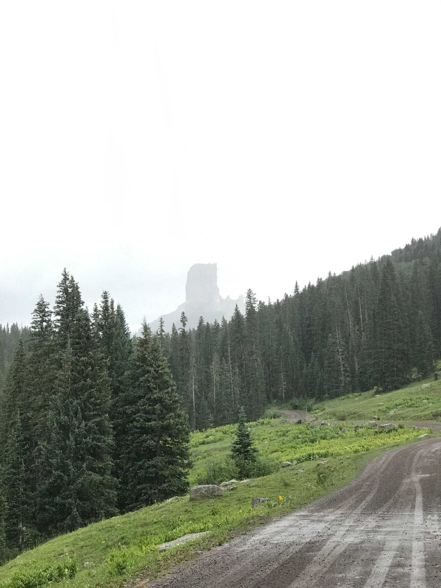
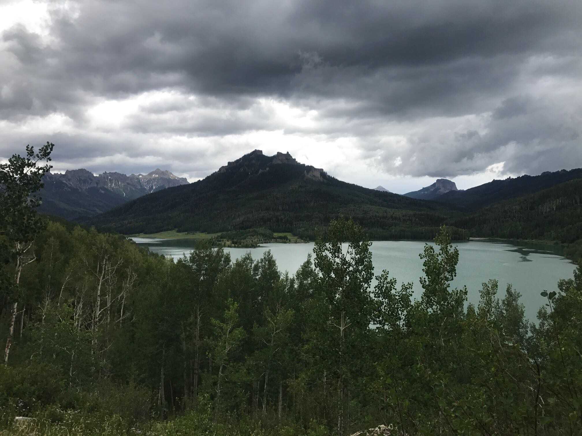
Owl Creek Pass, Colorado
44.1 kmOwl Creek Pass, Colorado is a really fun way to head from near Gunnison over toward Ridgway & Ouray. The trip is not quick and on this day we were covered in rain. It provides great views on very easy terrain, suitable for most SUVs.
My Photo - 7/22/17, 4:01:35PM
July 22, 2017
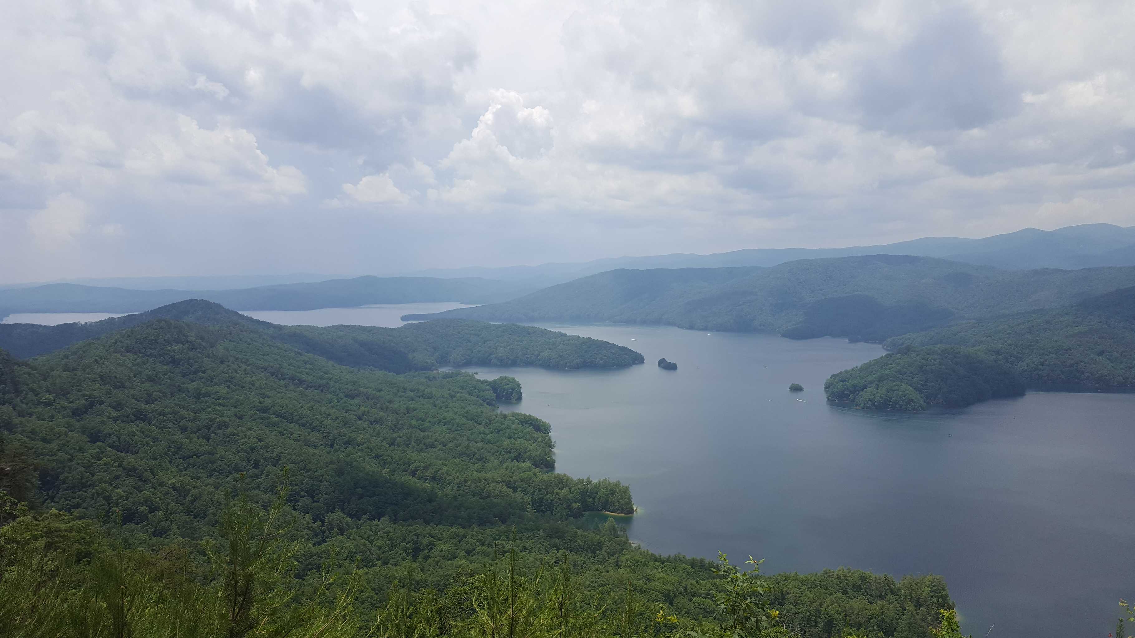
Silver Jack Reservoir, CO
31.9 kmThis short trip south of US-50 near Montrose & Gunnison provides easy access to a beautiful reservoir. Much less busy than many in the area, the easy dirt road is suitable for nearly all vehicle types.
My Photo - 7/22/17, 3:34:37PM
July 21, 2017
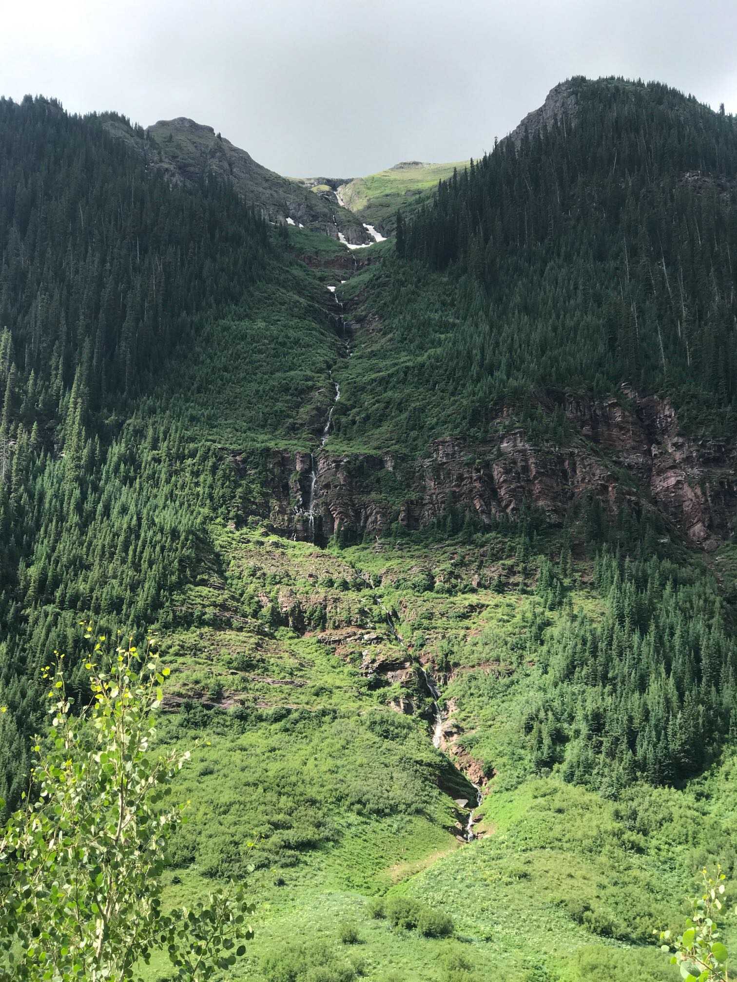
Clear Lake, CO
13.2 kmClear Lake is a mild trail that is suitable for any stock 4x4 or SUV with low-range. The drive includes magnificent views and ends at the amazing high-alpine lake, near 12,000ft.
My Photo - 7/21/17, 10:19:52AM
June 26, 2017
Canyonlands Needles District Planning/Horse Canyon
15.0 kmYou must have a permit for day and overnight use. This road is often impassible due to deep sand, deep water, and quicksand. The road is too sandy for mountain bikes. There are vehicle campsites at Peekaboo with prehistoric rock art nearby. Vehicles may not drive upstream of Peekaboo in Salt Creek Canyon. Horse Canyon road leads to several arches and Tower Ruin.
June 26, 2017
Canyonlands Needles District Planning/Confluence Overlook
4.9 kmThe Confluence Overlook is a short side-trip off of Elelphant Hill that brings you to where the Colorado and Green Rivers converge
June 26, 2017
Canyonlands Needles District Planning/Elephant Hill
11.5 kmYou must have a permits for day and overnight use. One of the most technical four-wheel-drive roads in Utah, Elephant Hill presents drivers and mountain bikers with steep grades, loose rock, stair-step drops, tight turns, and tricky backing. Once over the hill, equally challenging roads lead to various features as well as BLM lands south of the park. There is no water at any of the campsites, but there are primitive toilets at all camping areas except New Bates Wilson.
June 17, 2016
Created:
May 12, 2016
The Continental Divide (Range)
15776 kmWhile not the only divide in North America, The Great Continental Divide running from Mexico to Alaska is the primary geological feature that defines the continent. It has challenged explorers for eons and continues to entice modern day adventurers.
In 2016, Hema Maps will conquer the Great Divide through a truly special expedition. Our MAP001 200 Series Land Cruiser Map Patrol will explore and document the Great Divide throughout the summer, starting in New Mexico, USA and exploring along this epic natural feature through to the Arctic Ocean. In Fall 2016, our Map Patrol will add the western coast of the United States and Baja California, Mexico to the adventure.
Follow along at http://hemamaps.com!
June 17, 2016
Created:
June 04, 2016
Horse Pasture Rd
15.4 kmEasily passable dirt rd. Can be done in 2wd. Lots of campsites and overlooks. Many seasonal roads branch off the main road that go to Lake Jocassee and two rivers. Secondary roads to be added when gates open.
20160604_132611.jpg
May 31, 2016
Created:
May 22, 2015
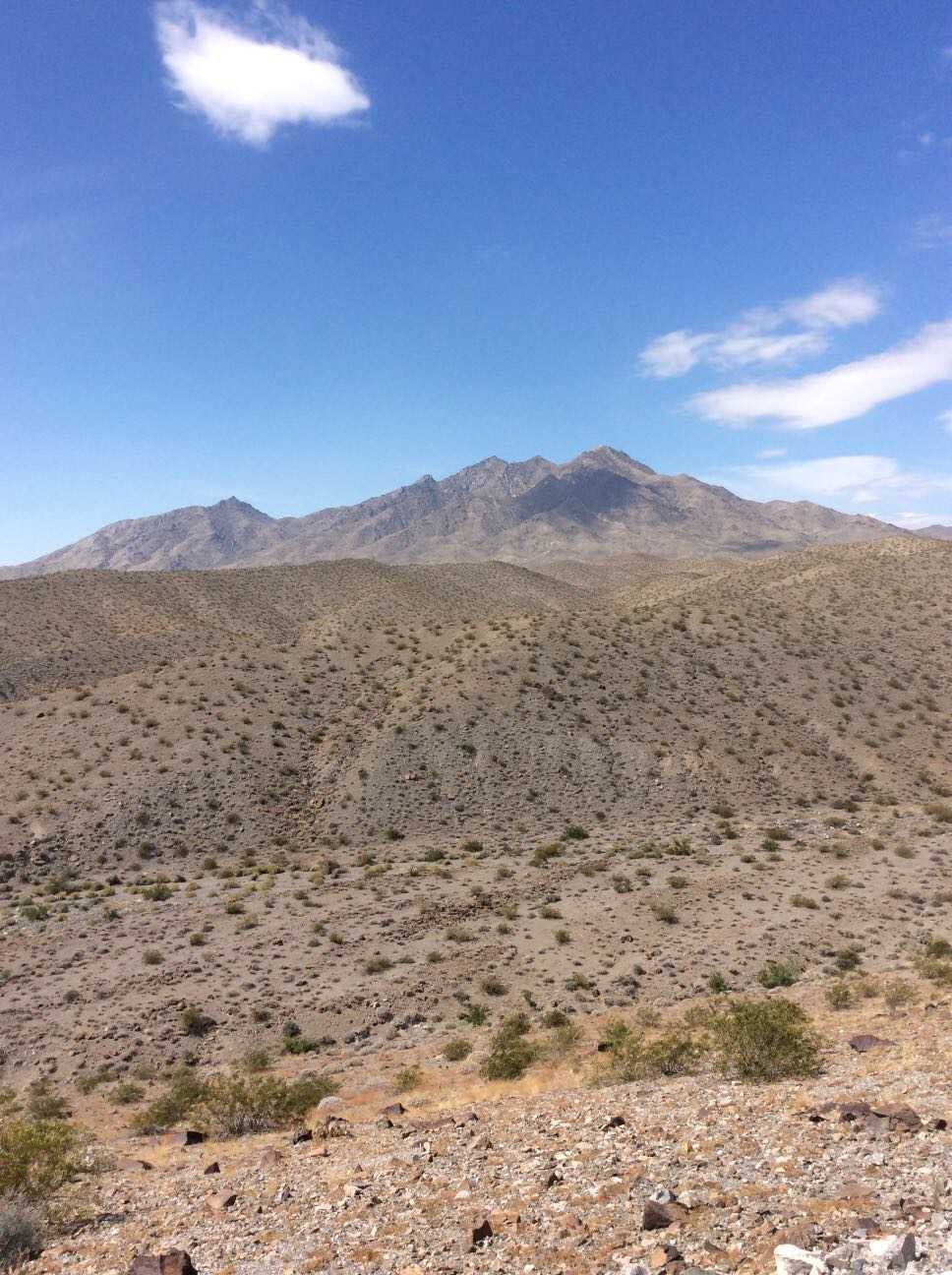
Hema Explorer - Map Patrol Mojave Road
356.2 kmThe Mojave Road traverses 140 miles of the Mojave National Preserve. Though not exceptionally technical, the remote water-less expanses, historical nature, and impressive topography have made this a classic overland track. We've added on to this scenic route to lengthen the trip and include a secluded beach camp site where travelers may escape the desert heat. The trail includes large sand washes, dry lake beds, heavy silt, steep ascents and descents, and cross-axle hills requiring low-range and careful tire placement.
Flora includes the unique Joshua Tree which appears as something out of a doctor Seuss book, yucca plants, cacti, creosote, and other plants typical of the desert southwest. Fauna ranges widely from owls, small mice, and rodent, to reptiles like gila monsters tortoise and chuckwalla, up to larger predators like cougars.
If you plan to traverse the route, we highly recommend coupling this GPS track with the Mojave Road Guide by Dennis Casebier. It gives an excellent overview of the trails history and provides interesting information along the way.
The track can be completed without refueling if you plan accordingly, however the town of Baker can be the perfect spot to hop off the trail, fill the tanks, and grab a cold drink to escape the heat. There is little to no support along the trail so be sure to bring food, water, a spare tire, and appropriate medical supplies for safety. A spot device or sat phone is recommended.