

June 01, 2016
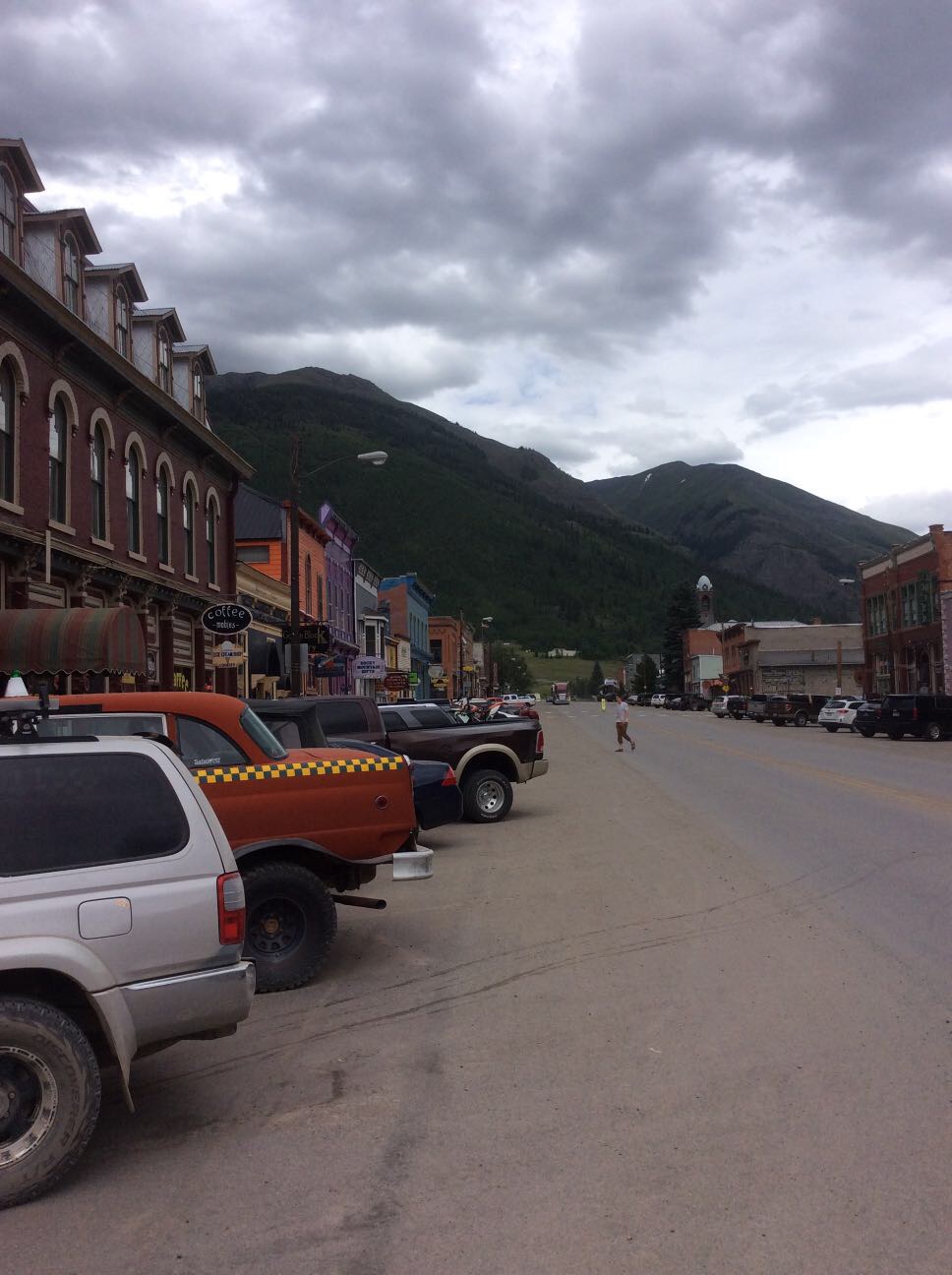
Black Bear Pass (Difficult)
14.9 kmTrail time: 5-7 hours
This is a heart-stopping and breath taking alpine trail to Telluride passing right by the spectacular Bridal Veil Falls. This is one of the most famous trails in the state and for good reason. It's beautiful and slightly terrifying. The Trail starts off 550, and return to Ouray over Ophir Pass from Telluride.
01aBlackBearWaterfall-ShaneWilliams.jpg
March 11, 2016
Poughkeepsie Gulch (Difficult)
6.3 kmTrail time: 4-6 hours
This trail is one of Ouray's more difficult trails, with absolutely beautiful views and some fun on rocks and water, depending on snow melt conditions. Additional obstacles add to the fun and challenge!
March 11, 2016
Animas Forks (Unofficial)
5.0 kmThis connector trail is not part of the FJ Summit, but connects Engineer Pass Rd with the Animas Forks Ghost Town and is a popular destination in the area.
November 12, 2015
Red Mountain Mining Area (Easy) (Unofficial)
14.6 kmThis is not an organized trail run at the FJ Summit.
November 12, 2015
Ophir Pass (Easy)
15.9 kmTrail time: 1-3 hours
This trail is fairly easy though you spend a lot of time on a shelf road. The road is usually narrow so if you have to pass someone it could be difficult and dangerous. The trail connects Telluride and Silverton and is very scenic. The Black Bear Pass and Imogene Pass trail runs will return from Teluride over Ophir Pass. Ophir Pass is also a good choice to make a loop to Teluride with Last Dollar Road.
November 12, 2015
November 12, 2015
November 12, 2015
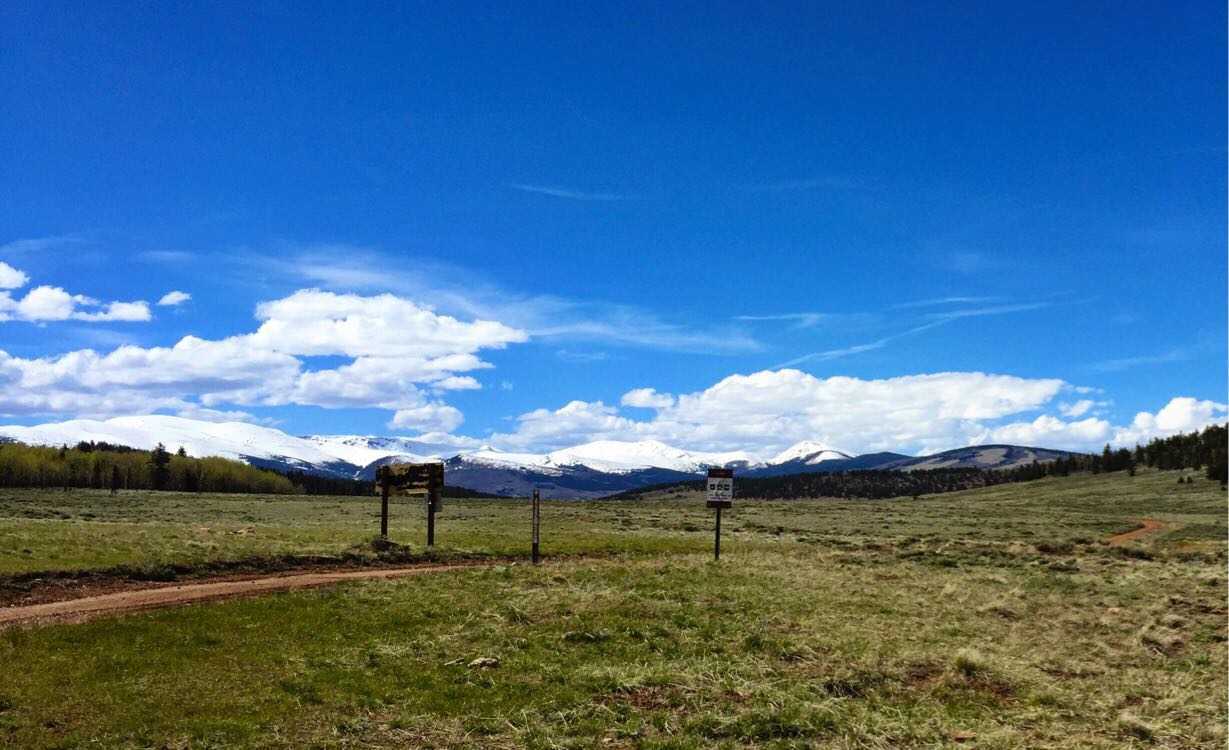
California Gulch (Easy)
8.0 kmTrail time: 1.5-3 hours
This trail is absolutely beautiful from start to finish. Though it isn't a technically challenging trail it does follow very narrow shelf roads and includes a stop at a ghost town!.
March 10, 2016
Created:
July 26, 2015
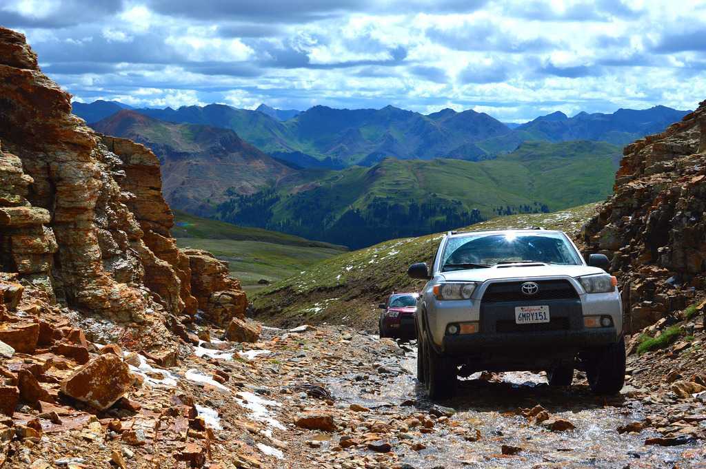
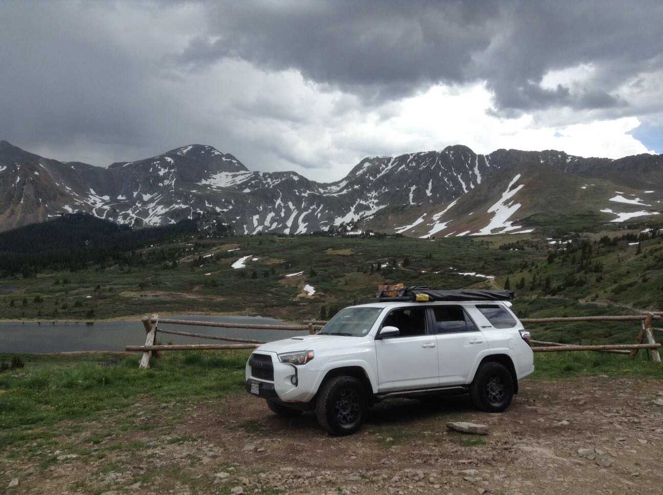
Hema Explorer - Map Patrol Alpine Loop
109.0 kmOur trip through the alpine loop was 70 miles through some of Colorado's most beautiful countryside. Scenic vistas, mountain passes, clear flowing streams, and varied wildlife are abundant along this route and every corner will reveal a new surprise. The trail came to prominence in the late 1800's when miners came in search of silver, gold, and ore. Needing a way to transport supplies and minerals via horse cart, they cut large paths through the mountains from Silverton to Lake City and finally to Ouray Coloarado. In many places signs of the mining rush still exist, from old bridges to buildings and even equipment that was left in place to rot away. Today these tracks are largely used by bikes and four-wheel drives and include some favorites like Cinnamon and Engineer Pass.
Though many parts of this loop are fast well maintained forest roads, there are sections which require low range and careful driving. Above all the roads are narrow and taking even a moment to look away can spell disaster.
Flora and fauna can range drastically in the alpine environment and it is all beautiful. Conifer, pine, and deciduous trees, wildflowers, shrubs, mushrooms, mosses, and lichens all have a strong presence in the area. Fauna include many species of bird, fish, goat, large cat, and of course bears. Caution should be used when camping along the loop to avoid attracting large predators. Be sure to contact local park rangers for more information on what to do around bears and large cats.
This track is not passable during many portions of the year and we recommend going from mid June up until the first snow of the year.. Always contact the local forest service for current road conditions and do not attempt if freezing conditions or snow are present on the trail.
My Photo - 7/26/15, 4:29:18PM
March 10, 2016
Created:
July 28, 2015
Hema Explorer - Map Patrol Imogene Pass
30.7 kmImogene pass is a beautiful track which runs between the towns of Ouray Colorado and Telluride Colorado. It happens to be the second highest pass in the state and reaches an altitude of 13,114 feet or 3,997 m at its crest. Although the majority of the trail is easy, one or two obstacles can pose a challenge to vehicles without high clearance. We recommend running the trail from west to east to make the main obstacles easier.
The drive has plenty to offer for adventurous drivers. In terms of scenery you'll witness snow covered peaks, crystal clear streams and lakes, large pine trees, and stunning wildlife. You will be challenged by several small water crossings, climbing and descending ledges, and traversing tight switch backs on both sides of the mountain.
Despite the relatively easy road conditions, extreme caution must be used. High cliffs and often slick surfaces can spell danger for touring motorists. Drivers must stop their vehicles if they wish to enjoy the view. Even a few seconds with your eyes off the road is enough to leave the narrow track and take a crushing tumble down the cliffs.
Imogene is only passable during brief periods of the summer, being covered by dense snow and ice the remainder of the year. Do not attempt under any circumstances to cross in winter conditions.
My Photo - 7/28/15, 2:47:36PM
February 23, 2016
Created:
May 21, 2015
February 23, 2016
Created:
March 21, 2015
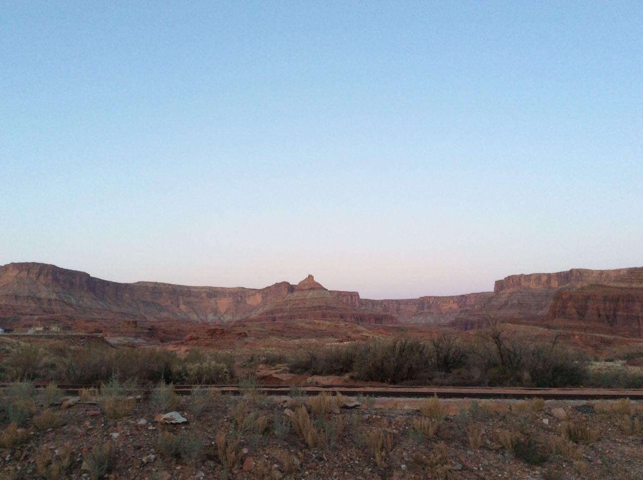
White Rim Road, Utah
203.7 kmThis is approximately a 100 mile loop which can be done in a full day. A more leisurely two day trip is recommended which gives the opportunity to try some of the impressive camp grounds. Although a lot of the track can be done in a conventional 2WD, certain sections require high clearance 4WD, especially the steep gradients and switchbacks.
We chose to join the White Rim Road via Potash Road from Moab which allowed us to both climb and descend the very impressive Shafer Switchbacks.
An entrance fee of $10 applies to all vehicles and camping fees also apply.
My Photo - 21/03/2015 7:13:21am
July 22, 2015
Created:
June 27, 2015
June 04, 2015
Created:
May 30, 2015